Wakefield Farm Map
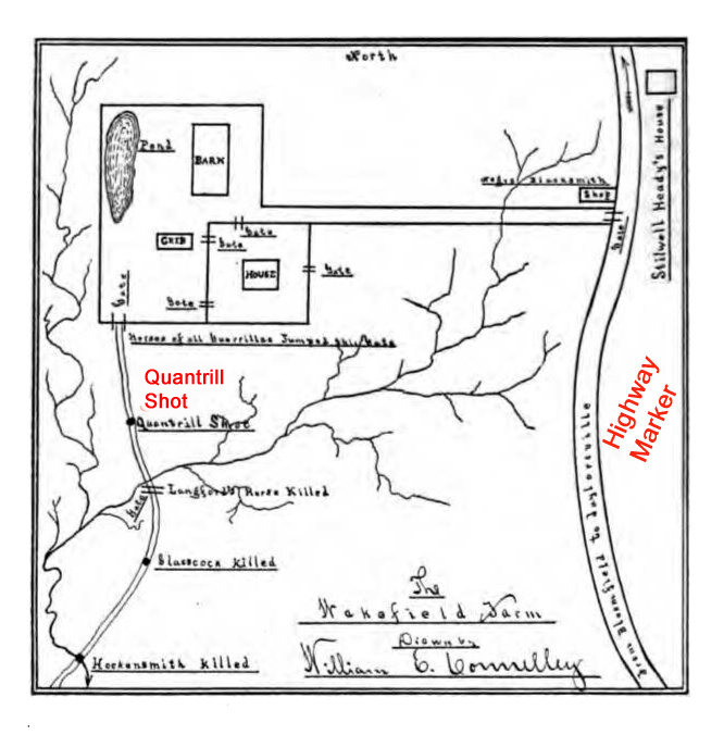 Here's the map of Wakefield Farm reproduced in William E. Connelley's Quantrill and the Border Wars (1910). I have added in red the spot where Quantrill was shot and the position, based on my reckoning, of the location of the historical marker, which appears in the photograph below. The GPS coordinates of the marker, for the geeks among us, are 37.97241 / - 85.31041.
posted by Max McCoy at
3:16 AM
![]()
![]()


<< Home